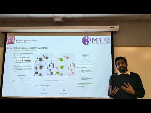
This research uses drone imagery and a hybrid AI model to classify rangeland cover as green vegetation, dead vegetation, or bare soil. Combining two neural network approaches achieved 96% accuracy while requiring only simple, low-cost sensors. The method enables fast, large-scale monitoring to combat invasive shrubs and support sustainable land management.

This project uses prescribed grazing to manage invasive vegetation and reduce wildfire risk in California. Grazing mimics natural disturbances, lowers hazardous fuels, improves soil health, and supports native biodiversity. The LandSmart Grazing Program funds landowners, builds infrastructure, educates communities, and strengthens local economies through sustainable, landscape-scale vegetation management.
Iowa’s prairies are nearly gone, but restored prairies may cool local climates through evaporative cooling. Deep-rooted, structurally diverse plants increase water transfer to the atmosphere, reducing surface and air temperatures. Using drones, LiDAR, and flux towers, the researcher quantifies prairie cooling as a climate-mitigation tool.