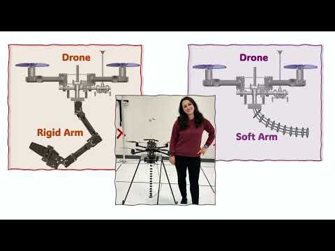
This research develops drones with soft robotic arms capable of safely grasping and transporting objects in challenging environments. By combining predictive modelling with visual feedback, it overcomes control challenges associated with soft materials. The work advances intelligent, adaptive aerial robotics for applications such as emergency delivery and hazardous environments.
2025
This thesis develops autonomous robotic systems for data gathering in complex real-world environments. It advances three areas: informative path planning, disturbance-aware planning, and predictive world modelling. The research introduces adaptive sampling-based planners for long-horizon information gathering, methods for estimating wind fields and planning safe, energy-aware UAV trajectories, and predictive mapping systems for indoor exploration. It also compares robot exploration strategies with human decision-making and uses those insights to build a reinforcement learning planner that performs at near-human level. Overall, the work shows that integrating long-horizon reasoning, environmental dynamics, and richer belief models can make autonomous robotic information gathering more effective, reliable, and scalable.
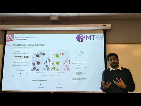
This research uses drone imagery and a hybrid AI model to classify rangeland cover as green vegetation, dead vegetation, or bare soil. Combining two neural network approaches achieved 96% accuracy while requiring only simple, low-cost sensors. The method enables fast, large-scale monitoring to combat invasive shrubs and support sustainable land management.

This research develops an AI-powered, multi-sensor drone system to detect butterfly landmines more safely and efficiently. By fusing sensor data into confidence-scored maps, it accelerates demining, reduces risk to operators, and supports civilian safety, land reuse, and humanitarian recovery in post-conflict regions.
Australia’s wildlife is hard to count due to difficult terrain and vast landscapes. This research uses remote sensing—camera traps, audio recorders, drones, and satellites—combined with AI and mathematical models to understand animal presence, habitat choices, and detectability. The goal is faster, more accurate population monitoring to guide conservation.
Iowa’s prairies are nearly gone, but restored prairies may cool local climates through evaporative cooling. Deep-rooted, structurally diverse plants increase water transfer to the atmosphere, reducing surface and air temperatures. Using drones, LiDAR, and flux towers, the researcher quantifies prairie cooling as a climate-mitigation tool.

2025
My research develops fault-tolerant, cooperative control algorithms for multi-drone formations carrying shared payloads. By detecting motor failures, restoring lost force, and autonomously reconfiguring drone positions, the system reduces load disturbances by up to 90%. These methods enable safer, more reliable drone-assisted rescue and delivery operations in hazardous conditions.